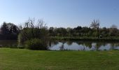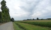

Les 5 Rottes
SityTrail - itinéraires balisés pédestres
Tous les sentiers balisés d’Europe GUIDE+

Length
9.3 km

Max alt
82 m

Uphill gradient
84 m

Km-Effort
10.4 km

Min alt
46 m

Downhill gradient
85 m
Boucle
Yes
Signpost
Creation date :
2022-02-15 18:12:34.708
Updated on :
2022-03-02 20:38:13.771
2h22
Difficulty : Easy

FREE GPS app for hiking
About
Trail On foot of 9.3 km to be discovered at Brittany, Ille-et-Vilaine, La Chapelle-des-Fougeretz. This trail is proposed by SityTrail - itinéraires balisés pédestres.
Description
Trail created by Commune de La Chapelle-des-Fougeretz.
Positioning
Country:
France
Region :
Brittany
Department/Province :
Ille-et-Vilaine
Municipality :
La Chapelle-des-Fougeretz
Location:
Unknown
Start:(Dec)
Start:(UTM)
594057 ; 5337021 (30U) N.
Comments
Trails nearby
Sentier des Melessiens


On foot
Easy
Melesse,
Brittany,
Ille-et-Vilaine,
France

8.5 km | 9.6 km-effort
2h 10min
Yes

Circuit de La Foucherais


On foot
Easy
Pacé,
Brittany,
Ille-et-Vilaine,
France

13.4 km | 14.8 km-effort
3h 22min
Yes
Circuit de La Rivière


On foot
Easy
La Mézière,
Brittany,
Ille-et-Vilaine,
France

9.1 km | 10.6 km-effort
2h 24min
Yes
Sentier de la Chaussée


On foot
Easy
Gévezé,
Brittany,
Ille-et-Vilaine,
France

14.6 km | 16.1 km-effort
3h 39min
Yes

Sentier de Montgerval


On foot
Easy
La Mézière,
Brittany,
Ille-et-Vilaine,
France

11 km | 12.3 km-effort
2h 47min
Yes
Circuit de la Boutière


On foot
Easy
Saint-Grégoire,
Brittany,
Ille-et-Vilaine,
France

9 km | 9.9 km-effort
2h 14min
Yes
Circuit du Moulin de la Moltais


On foot
Easy
Gévezé,
Brittany,
Ille-et-Vilaine,
France

7.8 km | 9.1 km-effort
2h 3min
Yes
Circuit de la Motte Marcillé


On foot
Easy
Gévezé,
Brittany,
Ille-et-Vilaine,
France

6 km | 7.1 km-effort
1h 36min
No
LA CHAPELLE DES FOUGERETZ / BEAUREGARD 10/01/2019


Walking
Very easy
La Chapelle-des-Fougeretz,
Brittany,
Ille-et-Vilaine,
France

12.3 km | 13.5 km-effort
3h 4min
No


 SityTrail


